Cappadocia is one of those destinations that every traveler dreams of visiting.
And once visited, they remain in the memory for life.
The uniqueness of its geological forms and the rock art that developed in them centuries ago have an incomparable charm.
And not by chance, the National Park which concentrates all (Göreme) was declared a Unesco World Heritage Site. in 1985.
If you want to enter into the most recondite of these lunar landscapes with caves of countless surprises, in this page you will find all the information you need to know.
First of all, you should know that the name Cappadocia is somewhat ambiguous and generic. historically and geologically homogeneous regionbut administratively it covers areas of four different provinces (Kayseri four different provinces (Kayseri, Nevşehir, Aksaray and Niğde).so probably for this reason you can not always locate it well on the map, as in fact in many of them it is omitted.
As we will see below, the reference cities to get here are the first two provincial capitals mentioned: Kayseri and Nevşehir..
En cambio, a nivel turístico, la verdadera ‘capital’ (pese a ser un pueblo pequeño) es Göreme.
Se considera el epicentro y, no en vano, el Parque Nacional que abarca los valles circundantes toma ese nombre.
In reality, it is a vast region covering approximately 50 km from one end to the other. 50 km from one end to the other.
Por lo que respecta al área protegida del Parque Nacional, su superficie es de unas 10,000 hectares.
Por ello, es habitual visitar este territorio en más de una jornada, para poder descubrir lo más importante con tiempo suficiente.
This historical region is located in Central Anatolia.
A continuación mostramos una lista de distancias que la separan de los principales destinos turísticos del país, para que puedas hacerte una idea de su cercanía o lejanía respecto de ellos:
Cappadocia is located on a plateau located at an altitude of about 1,100 meters above sea level..
Este hecho, unido a su lejanía con las costas turcas provoca que su clima sea de carácter continental.
En invierno, los termómetros se quedan en torno a los 0º, ligeramente por encima durante el día y por debajo durante la noche.
En cambio, en verano las temperaturas pueden subir hasta los 30º, aunque las noches suelen ser frescas.
On the other hand, rainfall relatively scarce rainfall, on the other hand.The rainfall in Cappadocia is about 100 rainy days and about 400 mm per year, being very infrequent in the warm months.
These conditions of relative stability facilitate the most famous activity in Cappadocia: the balloon rides, which we talk about below.
The great gateway to Cappadocia is the city of KayseriIt has a large international airport and numerous daily connections to major destinations in Turkey and other countries.
In addition, the nearby city of Nevşehir (about 20 km from Göreme) is the other locality that serves as access to this region.
Below are the main transportation options.
The large international international airport of this region is Kayseri.
Se encuentra a unos 80 km from Göreme, a distance that usually takes just over an hour by car. an hour’s driveif there are no traffic incidents.
This airport has a capacity of approximately one million passengers per year, a figure not as high as others in the country because it is almost exclusively dedicated to tourist flights.
But its daily operation and its network of air routes are very convenient to set up a tour of Turkey.
This is the list of destinations that are usually connected to this airport:
In addition to this Kayseri airport, there is another airport even closer to Göreme: Nevşehir Kapadokya airport. airport of Nevşehir Kapadokya.
Está a unos 40 km de Göreme y el trayecto por carretera entre ambos lugares dura unos 35 minutos.
En este caso, no es un aeropuerto internacional y, por tanto, los vuelos extranjeros que recibe son sólo chárter.
Además, su listado de rutas áreas es menor, pero las enumeramos a continuación por si resulta de interés:
The main train station station in the region is the one in Kayseri.
Hasta aquí llegan los trenes de diferentes líneas, aunque ninguna de ellas es internacional.
Algunas tienen salidas diarias, mientras que otras sólo varias a la semana.
Son las siguientes:
Another station in Cappadocia is Nigdewhere daily trains stop on the Erciyes Ekspresi line between Adana and Kayseri.
As with the trains, buses to Cappadocia come from other cities in Turkey, so their lines are not international. their lines are not international..
Debido a las largas distancias y tiempos de dichas líneas, are usually nocturnal.
Since most of these bus lines originate from destinations located west of Cappadocia, the reference station is. Nevşehir which, despite being smaller than Kayseri, is closer to those destinations (between the two there is about 80 km distance, which is more than an hour’s drive).
Up to Nevşehir station (otogarin Turkish) is served by buses from Istanbul but also direct lines from the main destinations of the Turkish coasts. (Aegean and Mediterranean), given the interest that Cappadocia has for tourists staying in them.
For that reason, some of these bus lines even connect with small towns in Cappadocia, such as Göreme or Avanos, without the need for transfers.
If your preferred option is to move around in a private vehicle, with a driver or on your own, it will be useful for you to know the distances distances between Cappadocia and the rest of the tourist destinations.
And in particular, the approximate time driving.
In this case, we take as a reference Göremelocated in the heart of Cappadocia:
In reality, what has really marked Cappadocia as we know it is not history, but prehistory.
Or rather, the geological history of the planet, evolving over much longer periods of time than humans.
To form the unique valleys of this region and, more particularly, the spectacular fairy chimneys in the rocka series of geological processes had to take place. geological processes very different geological processes.
A first milestone took place about 60 million years ago. 60 million years agoago: the formation of the Taurus Mountainswhose arc of mountains runs further south.
A consequence of the genesis of this mountain range was, precisely, the opposite: the formation of depressions further north.
Tiempo después, hace aproximadamente 10 million years, these depressions were ‘filled’ with magma and volcanic These depressions were ‘filled’ with magma and volcanic materials, expelled in numerous eruptions of Anatolian volcanoes.
These volcanic materials created the altiplano itself, but due to their fragility in the face of the erosion processes erosion processes (winds, rains, rivers, temperature changes), the current valleys were formed, with these unique rocky shapes, the result of differential erosion.
Already on a ‘human’ time scale, once the volcanoes had calmed down and the current valleys were formed, man began to inhabit these places from time immemorial, for reasons of logic and utility: the rock is relatively soft, which facilitated the creation of caves. creation of caves from natural cavities, which was the perfect natural habitat for prehistoric man.
We do not have much data on these first moments of settlement.
In fact, it is not clear what the etymological origin of the name ” Cappadocia“which, according to some linguists, could derive from the luvita “Katpatuka” (“low country” or “land of horses”).according to different interpretations).
It is known that already in the times of the Hittite civilization (from 1800 BC), these parts of Cappadocia were inhabited, although they did not reach the level of development of the cities of that empire, which had its epicenter in Central Anatolia.
The main troglodytic settlements in the area date back to the III and IV centuriesThe Roman Empire and the beginnings of Christianity.
This empire established the regional capital in Caesarea (today’s Kayseri).
This environment of quietness and difficult access favored the settlement here of the first followers of that religionwhen its worship was still forbidden by the pagan authorities.
Those caves inhabited and cared for by those primitive Christians were the origin of troglodytic churches and monasteries, also in Byzantine times. troglodytic churches and monasteries, also from the Byzantine period, and many of them decorated with medieval frescoes from the 11th century onwards. and many of them decorated with medieval frescoes from the 11th century onwards, which have come down to us thanks to the relative religious tolerance carried out by the Seljuk and Ottoman rulers centuries later.
However, the remote and ‘peripheral’ location of the valleys of Göreme was what really favored its preservation, the result of oblivion and ignorance of the place.
In fact, it was not until the year 1907 when these places became known: it was a French priest, a French priestGuillaume de Jerphanion, who fought for their cave churches to get the protection, recognition and admiration they deserve.
Since 1985, the Göreme National Park (also known as the Göreme Open Air Museum) and the rock sites in other parts of Cappadocia have been recognized as World Heritage Sites by Unesco, favoring the current development of tourism in the region. current tourism developmentwhich is the real economic engine of the area.
As we said, there is a lot to see in Cappadocia.
That, coupled with the scattered location of its points of interest, makes it advisable to use more than one day to discover the most important parts of this destination.
In addition, it is essential to have a private vehicle to move around the different locations, since the public transport network is very limited and does not provide valid solutions for a tourist circuit.
In most of our tours, we group the points of interest according to their proximity to each other.
We usually speak of North Cappadocia and South Cappadocia which, although they do not correspond to a real administrative division, do help to understand their location.

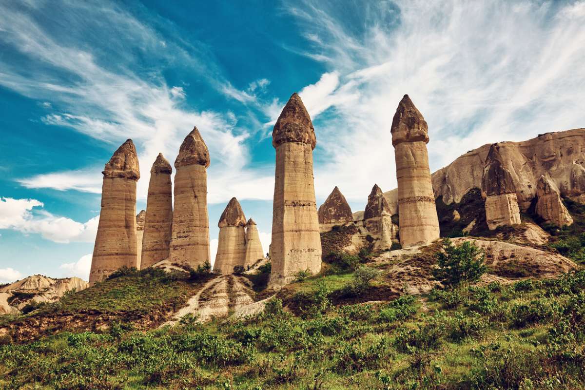
The image that any traveler conjures up in his mind when he thinks of Cappadocia is probably the one he encounters in the Devrent ValleyValley: here there is a large concentration of fairy chimneysThese rock formations in the shape of a cylinder, pyramid… or any other shape you can imagine.
In fact, this valley is also known as the Imagination ValleyThe rocks are a great place to see, since a walk through here brings it to the surface.
In these rocks it is easy to recognize animals, plants, architectural elements and much more.
It is also a good place to understand how differential erosion works, since you can still see in these cones the darker, flatter stones of the harder rock, visible after the surrounding sedimentary layer has disappeared due to wind or rain over millennia.
Nearby is Avanosanother most interesting locality: its source of life and wealth is the Red River. Red Riverso called because from its bed is extracted a red clay that is used as raw material in the famous local ceramics. local potteryThe pottery, so appreciated by the ancient Hittites and by the current inhabitants of the region.
There are workshops where you can see their craftsmen at work, as well as a museum (Museum of Ceramics Güray), located in caves underground.
As for the town itself, its most outstanding constructions are its large houses of the late Ottoman Empire.
In the surroundings of Avanos you can discover one of the most unique places of the Göreme National Park: Pasabagi or Valley of the Monks..
Se llama así porque las chimeneas de hadas fueron utilizadas tiempo atrás por monjes anacoretas, y de ello aún hay vestigios: some chimneys are accessible from the insideThe interior has wooden staircases and spaces decorated with crucifixes and other Christian elements.
The nearby area of ZelveIts peak was in Byzantine times between the 9th and 13th centuries, when the rock formations were filled with people devoted to prayer and contemplation, and this led to the development of other complementary constructions for the population, such as mills.
Siguió siendo habitado hasta mediados del siglo XX, hasta que se desalojó el entorno por riesgos estructurales, pues la erosión es un proceso imparable.
Es por ello que entre los espacios visitables de los tres valles también encontremos una humilde cave mosque.

In the southern sector there are other places of enormous importance.
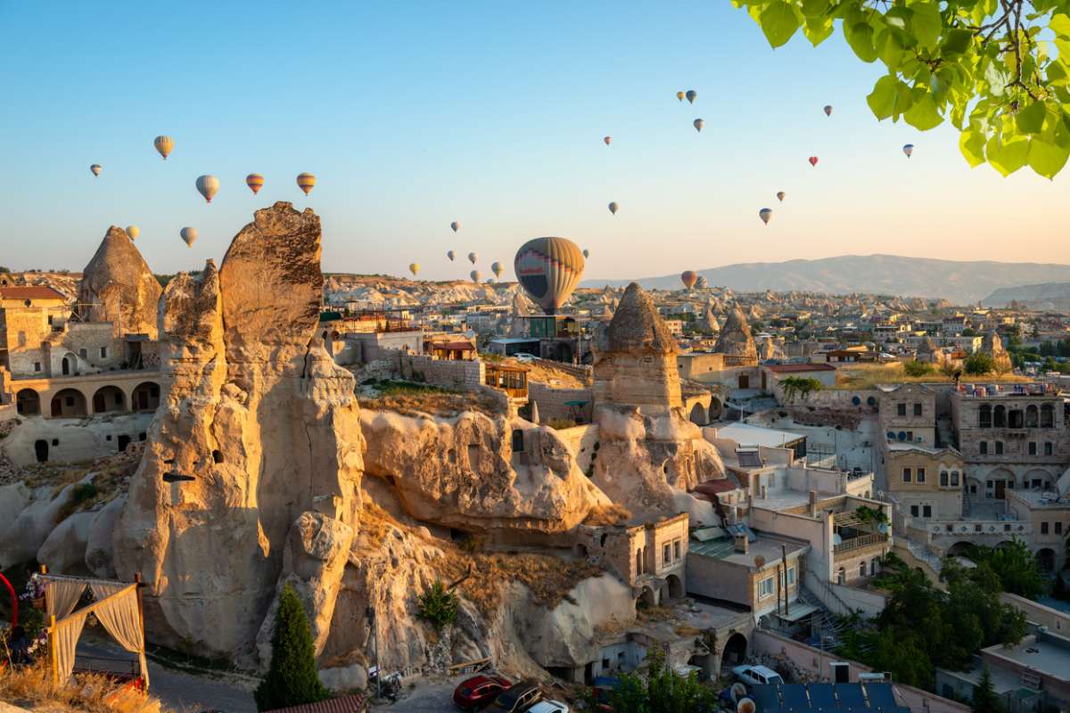
Without going any further, the town that gives its name to the National Park: Göreme.
Y como puede imaginarse, es también su epicentro turístico, pues es a su vez su quaintest placeDespite the proliferation of establishments aimed at visitors, sometimes of debatable taste.
But what cannot be denied is that its intricate streets, its restaurants and cave-hotels and its innumerable panoramic views of the surrounding lunar landscape are always spectacular.
The area around Göreme is also home to the largest concentration of rock-hewn churches which since Byzantine times has been a place of pilgrimage, as it is the birthplace of such popular saints as St. Basil or even St. Georgewhose main feat (the death of the dragon) is a ubiquitous episode in the decorations of the temples.
In fact, it is in Göreme where some of the most important most outstanding frescoesin troglodyte temples such as the church of the Serpent or the Dark church..
The beauty of South Cappadocia is visible on the surface, but also underground.
In the open air, for example, the Valley of Love (Aşıklar vadisi): Is a place often visited on romantic trips, as its rocks evoke the embrace of lovers or even the Three Graces, in allusion to the three Greek mythological characters, symbol of perfect beauty.
But in the so-called Subway CityBut in the so-called Underground City, the traveler is amazed to discover the long galleries used by the population centuries ago, among other reasons for its good air conditioning, with temperature stability throughout the year, which meant a cool environment in summer and mild in winter.
There is no lack of military and defensive constructions that, of course, also take advantage of the possibilities of the rock for its structure.
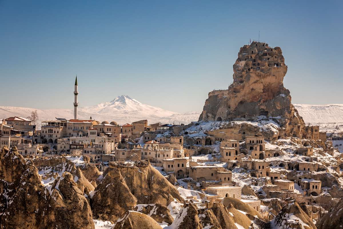
This can be seen in Ortahisarwhich has a rugged fortress that offers spectacular panoramic views from the top.
The same is true of Uçhisarwhose castle on the volcanic outcrop is visible for miles around and is full of tunnels that served as shelter for the local population.
Today, the picturesque arrangement of houses and mosques on its slopes offers one of the most iconic and evocative images of Cappadocia.
This atmosphere contrasts with that of the nearby ÇavusinAlthough it was also a village of cave-houses on the slopes of a great cliff, these dwellings were left uninhabited, leaving a breathtaking ruinous panorama, not without a certain charm.
That is the main reason why it is still very much visited today, as well as for the church of San Juan located at the top of the promontory, with an interior masterfully carved into the rock.
But the caves and grottos of this region have not only been used by humans, but also by animals.
Proof of this is the Valley of the Pigeons (Guvercinlik vadisi)In its caves nest innumerable birds, especially pigeons, which centuries ago were used as messengers.

All the places listed above are relatively close to each other.
But if you are planning to spend more than two days in Cappadocia, it will be worth your while to travel to more peripheral locations of Cappadocia, but no less interesting for that.
Above all, from a natural point of view.
For example, if you decide to travel to the Aladaglar National Park. Aladaglar National ParkThis protected area is located about 100 km from Göreme, in the Taurus Mountains, and is a real paradise for hikers. paradise for hikers.
Su rincón más icónico es, sin duda, las Kapuzbasi waterfallswhich offer a fall of dozens of meters high, reaching its splendor in spring.
Another hiking route of great popularity and beauty is that of the Ihlara Valleyabout 80 km west of Göreme.
Here, a trail through the Melendiz river gorges leads the hiker to Selime, between cave churches and a fresh landscape full of greenery, where the steep rocky walls are the perfect habitat for birds of prey and small reptiles.
Visiting Cappadocia with a guide is essential to not overlook any place of interest in this tourist destination.
But if you also want to do other activities in your free timeHere are some genuine suggestions.

It is probably the most famous activity in Cappadocia, as evidenced by the unmistakable photographs in which fairy chimneys and large cliffs coexist with hundreds of hot air balloons in the sky.
From the latter you can enjoy panoramic bird’s eye view that cannot be achieved in any other way.
These walks are subject, logically, to viability due to weather conditions, but they usually start at the beginning of the day. early in the morning to be able to start the flight with the first rays of light of the day, a moment when the colors of the landscape and the sky are especially magical.
The duration of these rides is usually one hour, delivering at its conclusion documents that immortalize the experience forever: a flight certificate, photographs and videos (depending on the package contracted) and even a champagne toast.
The traditional activity in the villages of Cappadocia, closely linked to the raw materials of the environment, has given rise to the most genuine handicrafts. genuine handicrafts.whose production is still very much alive thanks to tourism.
Therefore, if you want to shop for the most authentic, you can look for the following items or even the workshops where they are still produced by hand:

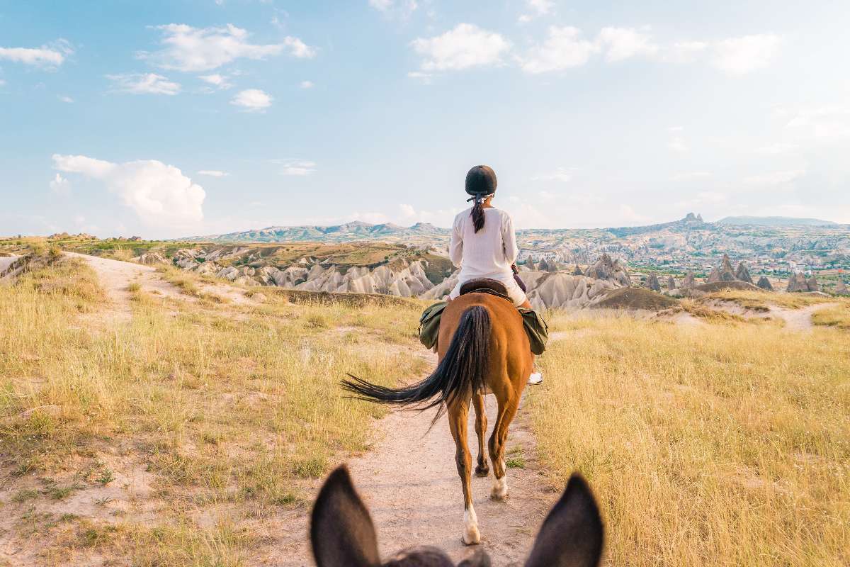
In such a unique natural environment, the sports activities that can be practiced here acquire a plus of interest.
And there are many companies and professionals that organize routes and experiences of this kind, which blend in seamlessly with the landscape.
Estos son algunos ejemplos:
Finally, another no less interesting proposal is to learn about the local culture first hand.
For example, through cooking classesoffered in some hotels or restaurants.
In this way, you can taste a typical Cappadocian dish made by yourself, such as lentil soups or its famous ‘stuffed’, either in vine leaves or eggplants.
Another no less interesting option is to roll up your sleeves and learn pottery in one of the pottery workshops mentioned above.
Using the classic potter’s wheel and the characteristic clay of Avanos and the Red River or Kizilirmak, the local masters teach how to create the famous pots and vases, which you can take home with you.
In spite of being a very touristy destination, the information information offices for travelers are conspicuous by their absence.
Por ello, lo más recomendable es organizar la visita de Capadocia previamente, con todo reservado o, al menos, sin dejar nada al azar.
The local transportation network is limited.
Although there are minibuses that connect different towns, both their frequency and capacity are absolutely insufficient to meet the travel needs of tourists.
In any case, it is worth knowing that there is a fixed minibus route that runs through some of the most interesting towns, such as Ürtüp, Ortahisar, Göreme, Çavusin, Zelve or Avanos.
Therefore, the best way to get around Cappadocia is by private means of transport. private meansWhether it is a cab, a rental car or a chauffeur-driven vehicle.
In the case of cabs, they can operate with a taximeter or with a fixed rate, to be stipulated before starting the trip.
The motorcycle is also a feasible means of transport, very popular with two-wheeled enthusiasts, as the roads of this National Park offer spectacular views of the surroundings.
Finally, for travel to and from the airports, shuttle buses are available. to and from the airports, shuttle buses are available.operated by private transport companies.
They offer tickets in both directions to both Kayseri International Airport and Nevşehir Airport.
However, they do not have fixed departures, but rather. must be reserved in advance in order to enjoy the service.


