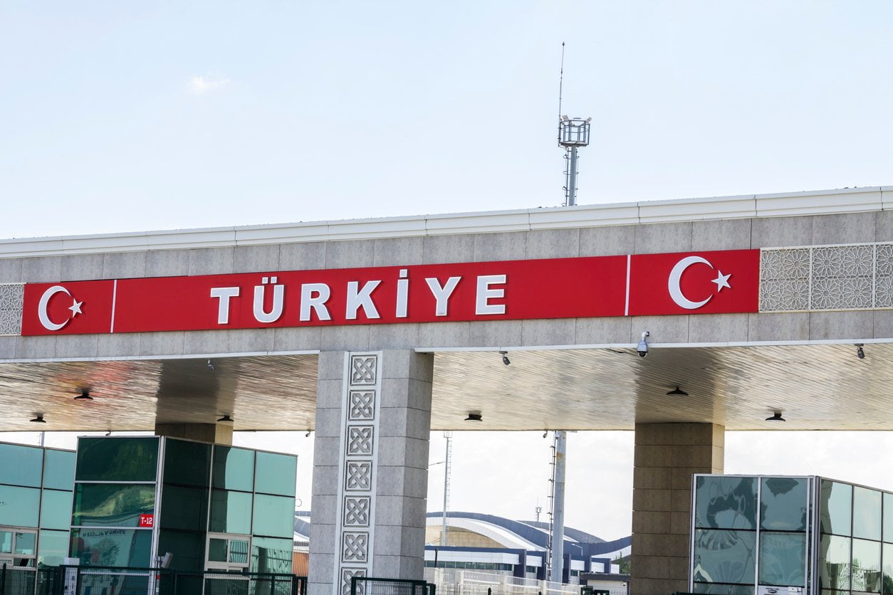
Few countries in the world can boast a geography as varied as that of Turkey.
And that has a great advantage: its enormous possibilities for tourism, offering natural attractions for travelers of all kinds.
On this page we will tell you about Turkey’s geography, with its main attractions. relief features, seas and other spaces of great importance, in many cases still untouched or little modified by man.in many cases still untouched or little modified by man.
Turkey is a very large country: it has an area of about 770,000 km². 770,000 km² in areaTurkey is one of the 40 largest states in the world.
But one of the most unique aspects of Turkey’s geography is its peculiar location: its territory is divided between two continents, Europe and Asia, with the border between themThe border between the two is the maritime strip formed by the Bosphorus Strait, the Sea of Marmara and the Bosphorus Strait, the Sea of Marmara and the Dardanelles..
Al oeste de todo ello, queda la parte europea de Turquía; y al este, la asiática.
The European part of Turkey is known as Eastern Thrace and is much smaller than that of Asia, accounting for barely 3% of its total territory.
However, it is of great importance from a tourist and symbolic point of view, since it is considered the ‘anchor’ of this country with respect to the West.
On the other hand, the Asian part is known as Anatolia, Anatolian Peninsula or Asia Minor. Anatolia, Anatolian peninsula or Asia Minor..
Por su enorme tamaño, alberga los principales espacios de interés de la geografía de Turquía, con grandes cadenas montañosas, lagos y otras vastas áreas naturales que fascinan a turistas de cualquier gusto y procedencia.
To all this must be added another interesting detail of Turkey’s geography: its islands.
Alrededor de una treintena de islas de diferentes tamaños forman parte del territorio turco.
Más de la mitad se ubican en el mar Egeo, lo cual no supone un número muy significativo si lo comparamos con las de su vecino europeo, Grecia, que tiene la soberanía sobre la inmensa mayoría de islas en el Mar Egeo (unas 5.000 entre islas e islotes, de las cuales unas 100 están habitadas), incluso de aquellas que se encuentran a unas pocas millas de la costa turca y son perfectamente visibles desde tierra.
In addition to the Aegean islands, Turkey has sovereignty over more than a dozen islands scattered between the Sea of Marmara, the Mediterranean Sea and the Black Sea, as well as some lake islands.
Turkey shares more than 2,600 km of border with other neighboring countries, both in Europe and Asia:
To all this must be added the maritime boundaries that separate its waters from those of Greece in the Aegean Sea and Cyprus in the Mediterranean Sea.
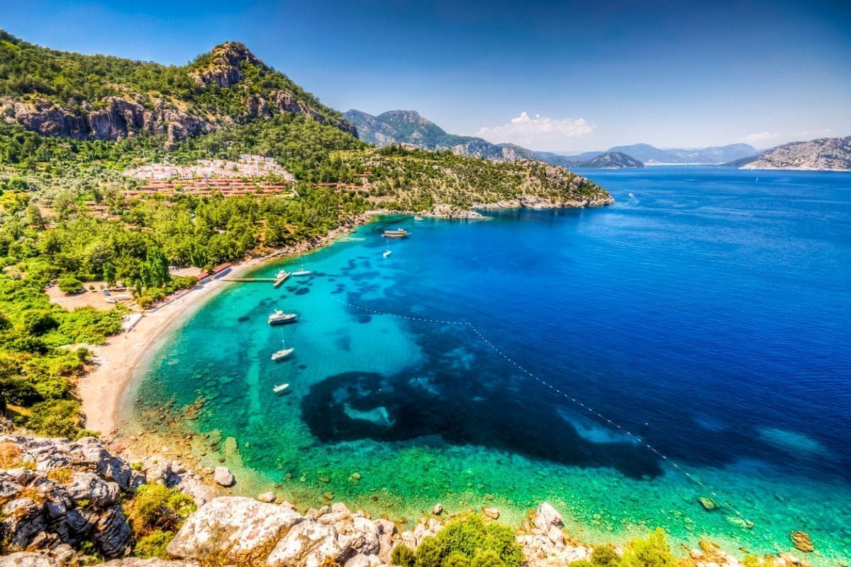
There is another aspect that stands out powerfully in the geography of Turkey: the great extension of its coastline.
They are about 7,200 km of coastlineThe following seas, each one with its own characteristics, bathe the waters of the following seas:
Encompassing the territory of the latter two coasts (the Aegean and the Mediterranean), is the so-called Turquoise Coasta concept that is more touristic than geographical and that refers to the most visited and appreciated portion of the coastline for holiday tourism, due to its combination of favorable climate, beautiful natural landscapes, quality infrastructures and first class archaeological sites.
In addition to all this maritime ecosystem, Turkey’s geography is also composed of some important lakes. important lakes.
El más grande de todos ellos es el Lake VanIt is approximately 120 km long by 80 km wide (just over 3,700 km²).
Slightly less than half of that area has the Lake TuzThe Ataturk reservoir, in central Anatolia, and like the previous one, has the character of an endorheic saline lake.
After them, we can mention large artificial reservoirs, such as Ataturk or Keban, both in the region of Southeastern Anatolia.
The location of these and many other lakes in the east of the country is explained by the more rugged terrain in that area.
For mountain lovers, Turkey is a true paradise.
Whether it is mountaineering, skiing, trekking or any other leisure activity related to mountain environments, the country has a lot to offer. rugged terrain gives rise to spaces of enormous beauty and interest.
The flattest and and steppe-like is that of Eastern ThraceIn the European part of the country, except for some modest elevations on the border with Bulgaria, about 1,000 meters high.
On the other hand, practically all of Anatolia is characterized by an irregular and even abrupt relief in many sectors.
Anatolia is formed as a large plateau great plateauThe relief rises steeply from the coastal areas of the Black Sea, the Aegean and the Mediterranean, so that the interior of this large peninsula has an average altitude of about 900 meters above sea level.
However, there are higher elevations and mountainous areas with high peaks and deep valleys.
This is a list of the main mountain ranges:
The list reflects only the major mountain ranges of the country.
But in these or in other areas of the country not strictly mountainous, there are other areas of very high geological value.
The region of Cappadocia and its Göreme valleysunique in the world for their abundance of ‘fairy chimney’ type formations.
No less extraordinary are Pamukkale and its terraces of limestone and travertine, which look like waterfalls of ice.
In addition to these areas of mountainous relief, there are vast areas of a more steppe-like character and, due to their continental climate, of an arid or semi-arid environment.
This is the case in the flatter lands of southeastern Anatolia, and even in large areas of Central Anatolia, where the capital, Ankara, is located.
Another consequence of the uneven and mountainous relief of Turkey’s geography is the abundance of rivers abundance of riversSome of them are really long, with more than 1,000 km in length.
However, the vast majority of them are not navigable because of the rapidity of its waters.
And perhaps because of this, their names are not as famous as those of other countries, nor have they historically been used as significant means of communication.
The longest river is Kizil Irmak, about 1,150 km long.
Everything we have been talking about Turkey’s geography is ‘what you see on the surface’.
However, there is another aspect that determines much of its nature and that is not seen because it is below, far below: the tectonic plates on which it sits.
The Anatolian Peninsula sits on the so-called Anatolian Plate. Anatolian Plate.
Al norte de ésta está la placa Placa Euroasiática, al sur la Africana y al sureste, la Arábiga.
Paralela a la costa sur del mar Negro discurre la falla del norte de Anatolia, mientras que en el Antitauro se ubica la falla de Anatolia Central.
Por ello, cuando Placa de Anatolia se ve empujada por las del sur (Africana y Arábiga), queda comprimida con la Euroasiática.
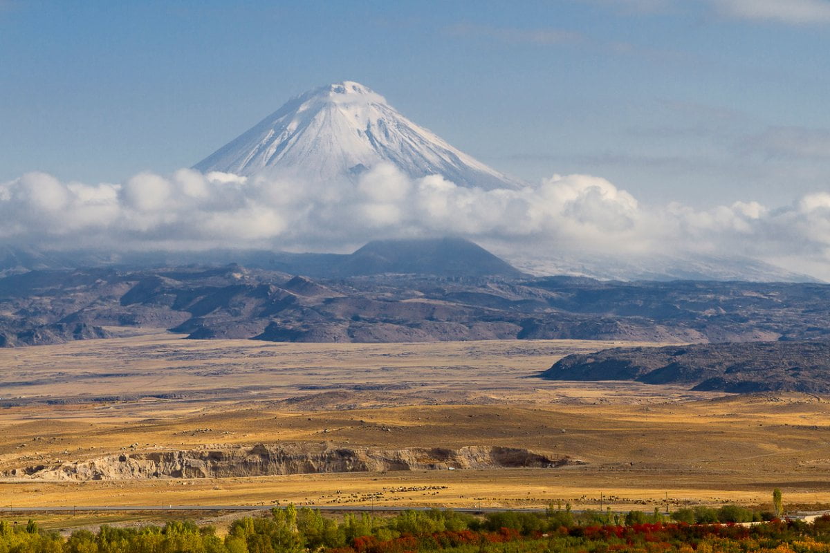
This arrangement of tectonic plates and faults has had an important consequence for the natural relief of Turkey: the existence of numerous volcanic volcanoes which, in many cases, are the highest peaks in the country, such as Mount Ararat itself.
Its volcanic activity is also behind the formation of unique natural spaces, such as the fairy chimneys of Cappadocia.
And in the short term, plates and faults are responsible for the country’s seismic activity.
That is why some of the world’s most renowned seismologists travel here to conduct on-site research, such as earthquake prediction.
And it is also why the country has placed increasing emphasis on emergency protocols, especially in Istanbul.